

 GAMES
GAMES
 Collections
 Game points
 BLOG
BLOG


- Added:
- Updated:
GTA 6 takes place across Leonida, Rockstar’s fictional version of Florida, with Vice City serving as its main urban center. Rockstar has officially named six destinations, but it has not released the complete map, exact boundaries, or an official comparison with GTA V.
Vice City, Leonida Keys, Grassrivers, Port Gellhorn, Ambrosia, and Mount Kalaga are confirmed. The road network, distances between regions, full coastline, and most square-kilometer figures circulating online remain unofficial.
What Has Rockstar Confirmed About the GTA 6 Map?
The story takes place in the state of Leonida, which combines a modern Vice City with islands, wetlands, industrial communities, declining coastal towns, and wilderness.
Rockstar’s official GTA 6 materials currently identify six major destinations:
| Location | Status | Real-World Inspiration | What Remains Unknown |
|---|---|---|---|
| Vice City | Confirmed | Miami | Complete district layout and city boundaries |
| Leonida Keys | Confirmed | Florida Keys | Number of islands and full road network |
| Grassrivers | Confirmed | Everglades | Exact boundaries and available activities |
| Port Gellhorn | Confirmed | Florida Gulf Coast towns | Size and position relative to Vice City |
| Ambrosia | Confirmed | Central Florida industry | Complete settlement and surrounding roads |
| Mount Kalaga | Confirmed | Southeastern US wilderness | Full park boundaries and playable activities |
These locations appear in Rockstar’s official Only in Leonida presentation rather than coming solely from leaked development footage.
For a broader overview of the release date, platforms, story, and confirmed features, see our complete GTA 6 guide.
Vice City
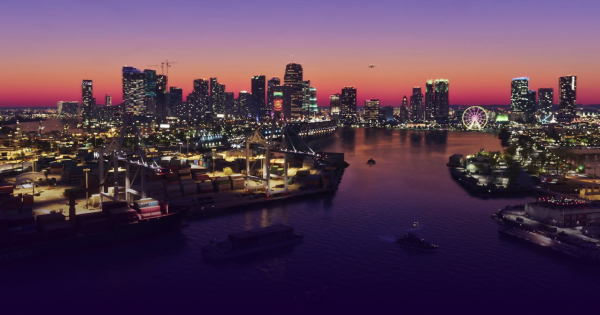
Vice City is the main urban setting and the location shown most extensively in the official trailers. The footage establishes a modern coastal metropolis with beachfront hotels, neon nightlife, heavy traffic, high-rise business districts, marinas, residential neighborhoods, and highways extending inland.
Miami is the obvious real-world influence, but this is not simply a larger copy of the 2002 map. The new Vice City sits within an entire state and appears to include substantially more urban and suburban development than its original version.
Several confirmed GTA 6 characters are connected to the city’s criminal, property, and music industries. That makes Vice City the apparent narrative center of Leonida, even though Jason and Lucia’s story will also take them into the surrounding regions.
Leonida Keys
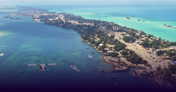
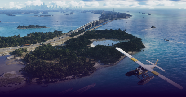
The Leonida Keys are a tropical island chain inspired by the Florida Keys. Official material shows bridges, shallow coastal water, boats, small communities, and island environments far removed from Vice City’s dense streets.
The Keys are also part of Jason’s background. Rockstar states that he spent time in the area working for local drug runners before the main events of the story. That connection suggests the region will be more than a scenic location, although Rockstar has not outlined its missions or activities.
Community reconstructions usually position the Keys south or southwest of Vice City, following Florida’s real geography. That placement remains an estimate until Rockstar publishes a complete map.
Grassrivers
Grassrivers is Leonida’s wetland region and the game’s clearest parallel to the Florida Everglades. Alligators, airboats, flooded grassland, mangroves, and narrow waterways appear throughout official GTA 6 footage.
These scenes confirm that wildlife and water travel are important parts of the environment. They do not confirm specific hunting mechanics, races, swamp missions, or collectible locations.
Grassrivers should therefore be treated as an official region, while detailed interactive maps of its routes and activities remain speculative.
Port Gellhorn
Port Gellhorn is an officially named coastal destination that contrasts with the wealth and glamour of Vice City. Rockstar presents it as a former vacation spot affected by economic decline, with cheap motels, abandoned attractions, empty strip malls, and struggling local businesses.
The setting appears designed to represent the less prosperous side of Leonida’s coast. Its atmosphere is closer to a declining Gulf Coast community than a second version of Miami.
Whether Port Gellhorn qualifies as another major city or a smaller coastal town has not been established. It should not yet be compared with locations such as San Fierro or Las Venturas from GTA: San Andreas.
Ambrosia
Ambrosia represents Leonida’s industrial interior. The area is built around the Allied Crystal sugar refinery, which dominates local employment, while the Final Chapter biker gang plays a major role in its criminal activity.
This location gives the map a working-class and industrial environment outside the main coastal destinations. It also indicates that Leonida will include more than beaches, swamps, and metropolitan streets.
Rockstar has provided enough information to confirm Ambrosia as a distinct destination, but not enough to determine whether the name applies only to the town or to a larger surrounding region.
Mount Kalaga
Mount Kalaga National Park forms part of Leonida’s northern wilderness. It is the most geographically unusual confirmed location because Florida itself is largely flat. The terrain suggests that Rockstar is drawing from the broader southeastern United States rather than recreating Florida literally.
Rockstar describes Mount Kalaga in terms of hunting, fishing, and off-road trails. That indicates the type of outdoor environment the park is intended to provide, but it does not yet confirm individual activities, mission systems, or minigames.
Mount Kalaga’s position near Leonida’s northern border is official. Fan-made estimates of its height, size, trails, and connections to other settlements are not.
How Big Is the GTA 6 Map?
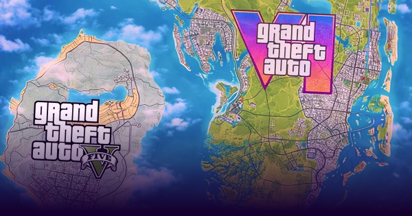
Rockstar has not announced the size of Leonida in square kilometers or square miles. It has also not published an official size ratio between GTA 6 and GTA V.
Community mapping projects try to estimate the map by comparing trailer frames, roads, vehicles, landmarks, coordinates, and details visible in early development footage. Their results vary because they do not all use the same source material or measurement method.
Some calculations include only visible land, while others add water, assumed northern territory, or sections reconstructed from the 2022 leak. As a result, claims that GTA 6 is exactly a certain percentage larger than GTA V should not be treated as confirmed.
| Question | Current Answer |
|---|---|
| Has Rockstar published an official map size? | No |
| Is the complete official map available? | No |
| Is Leonida likely to be larger than GTA V’s map? | Possible and widely expected, but no official ratio exists |
| Are current community size estimates reliable? | Useful for general comparison, but not accurate enough to treat as final |
| Can traversal time be calculated before release? | No reliable calculation is possible |
| Will GTA 6 have the largest map in the series? | Possible, but final measurements are not available |
The six confirmed destinations show that Leonida contains greater environmental variety than a map centered only on Vice City. That does not automatically reveal its total area.
Map density will also be important. A smaller urban zone with detailed interiors, traffic, side activities, and vertical spaces can offer more usable content than a larger region made up of long stretches of open terrain.
Which GTA 6 Map Claims Are Still Unconfirmed?
Several claims frequently appear in GTA 6 map coverage despite having no current confirmation from Rockstar.
| Claim | Current Status |
|---|---|
| Complete outline of Leonida | Unconfirmed |
| Exact map area | Unconfirmed |
| Kelly County and other leak-derived names | Unverified |
| Exact district and road boundaries | Unconfirmed |
| Dynamic hurricane system | Unconfirmed |
| Driving time across the map | Unknown |
| Number of enterable buildings | Unconfirmed |
| Post-launch map expansions | Unconfirmed |
Official footage does show varied weather, including rain, dark skies, strong wind, and wet roads. Those scenes do not prove that GTA 6 contains a dynamic hurricane system or dedicated hurricane missions.
Airboats and other watercraft also appear in official material, but their presence does not confirm races, missions, customization systems, or other specific gameplay mechanics.
How Accurate Are Fan-Made GTA 6 Maps?
Fan-made maps can help players understand the likely shape of Vice City and its surrounding regions. The best projects compare landmarks across several official screenshots and trailer scenes while identifying which sections are confirmed, estimated, or based on early development material.
They are still reconstructions rather than maps extracted from a finished game. Camera perspective, incomplete terrain, changing assets, uncertain distances, and assumptions about scale can all produce errors.
Before relying on a community map, check whether it:
- Separates official footage from leaked information.
- Labels approximate locations and boundaries.
- Identifies the version and date of the reconstruction.
- Explains whether water is included in size calculations.
- Avoids presenting collectibles, interiors, or missions as confirmed.
A fan-made map can provide general orientation before release. It cannot yet provide reliable routes, travel times, exact distances, or a definitive picture of the finished world.
GTA 6’s Vice City vs. the Original Map
The original GTA: Vice City presented a compact 1980s city divided between two main islands and several smaller connected areas. GTA 6 returns to the same fictional location in the modern era, but the official footage shows a much broader urban environment surrounded by the rest of Leonida.
Miami’s beaches, art-deco buildings, islands, downtowwn towers, and nightlife remain central influences. However, Rockstar has not confirmed the return of specific locations such as the Malibu Club, Starfish Island, or the Vercetti Estate.
While waiting for GTA 6, players can revisit earlier entries and other Rockstar releases through GamerAll’s GTA games collection.
What We Know About the GTA 6 Map So Far
Rockstar has confirmed a state containing a modern Vice City, tropical islands, wetlands, a declining coastal destination, an industrial community, and northern wilderness.
What remains unknown is the exact shape and scale of that world. There is still no complete official map, verified surface-area measurement, confirmed travel time, or final road network.
For now, Vice City, Leonida Keys, Grassrivers, Port Gellhorn, Ambrosia, and Mount Kalaga belong in the confirmed category. Exact boundaries, size comparisons, and fan-made layouts should remain labeled as estimates until Rockstar publishes more information or the final game becomes available.
If you are preparing for launch, our GTA 6 editions and pre-order guide explains the available versions, platform differences, and purchasing options.